Traffic Circulation Plan Centrum & Pedestrian Area
The Hague
[Jenna, Molly, Maddy]The Hague is the third largest city in the Netherlands, and is home to all governmental affairs within the country. The main center of the city is packed with shopping, restaurants and governmental buildings. As a result, the center and its surrounding areas are constantly filled with pedestrians, bicycles and car traffic attempting to gain access to all the city has to offer. In recent years, The Hague has transformed its city center from a car-centric area to to a bustling, limited access center. Street level parking lots have been transformed into outdoor seating and terraces, roads have been demoted, and some streets have even been completely closed to vehicle traffic. The locus map below shows the existing conditions of the area. The gray roads demonstrate areas where cars are not allowed access.
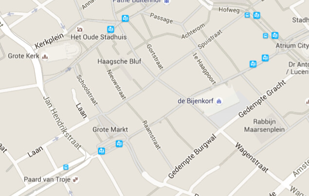
Figure 1. Is a map of the current city center of the Hague, where the gray roads represent areas not accessible to cars.
A primary example of this redevelopment is the Grote Marktstraat. In the early 2000’s the area was overfilled with every mode of transportation. The area was unsafe to the cyclists and pedestrians who were at risk of being hit by passing vehicles or trams. Included below are two photos that demonstrate the conditions of road before any of the recent alterations were made.
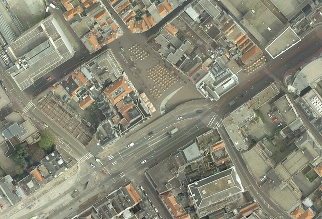
Figure 2. Aerial from 2006 of Grote Marktstraat.
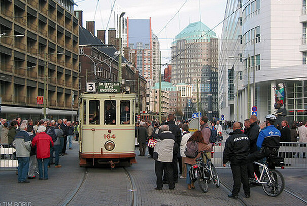
Figure 3. Is an image of Grote Marktstraat in 2004 which depicts the proximity between the many pedestrians the the tram.
Grote Marktstraat was analyzed and adjusted to incorporate sustainable transportation practices primarily by separating the traffic according to mass, speed, and direction. First, cars were completely eliminated from the area, which immediately increased the safety of the pedestrians and bikers tremendously. The tram was moved from at grade tracks, and installed beneath the surface. This allows for more frequent and efficient tram service to the center, while also promoting the safety of the many shoppers. The route now consists of a large two way cycle area, with ample room for pedestrians on either side. These changes have been wildly successful in reducing accidents, and the city of The Hague is looking to expand the pedestrian/bike only areas in the city center. Below you will find two photos that show the existing conditions of the street.
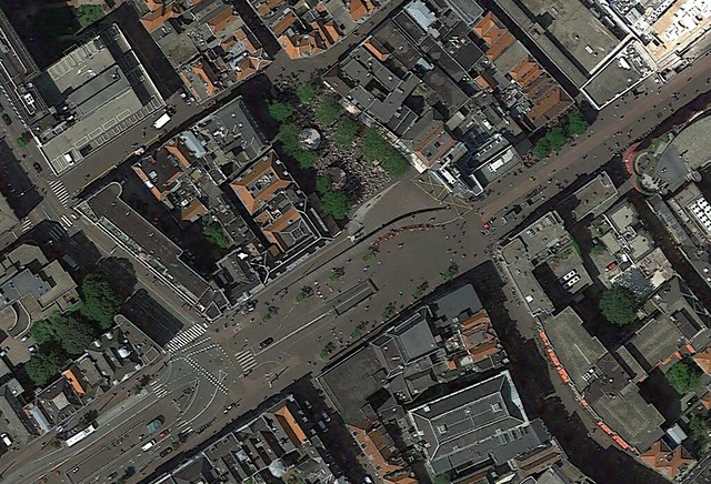
Figure 4. Aerial from 2015 of Grote Marktstraat.
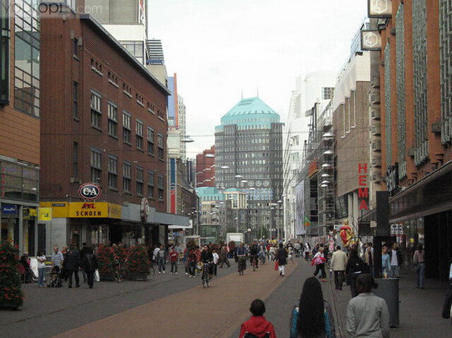
Figure 5. Is a street view of Grote Marktstraat granting access only to pedestrians and bikers.
Future Updates
When considering what areas might benefit from decreased traffic and increased public space, two streets come to mind. The first is Buitenhof through Hofweg between where cars are blocked at Achterom and Lange Vijverberg, and the second is Noordeinde between Heulstraat and Hogewal, shown on the locus map below. Both of these streets have already been closed to vehicle through-traffic in other sections, and we believe expanding the pedestrian-only zone would benefit not only shoppers, but also the surrounding shops and restaurants.
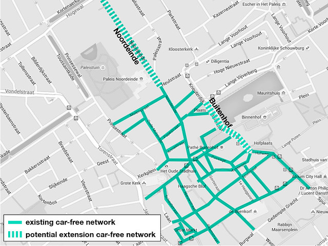
Figure 6. Locus map of potential areas for car-free extension.
Buitenhof
Buitenhof is a very busy street near the Binnenhof, or inner court, in The Hague. While a portion of the street has already been closed off to vehicle through traffic (east of Achterom), the portion of the street in front of the Hofvijver is very busy, serving cars, busses, trams, bicycles, and pedestrians. Included below are photos of the existing closed off portion, and the section that we wish to demote.
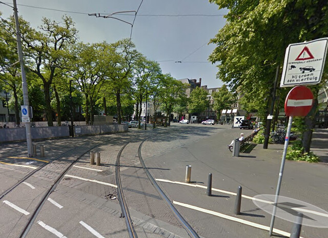
Figure 7. Streetview of Buitenhof east of Achterom that is currently closed off to vehicular through traffic.
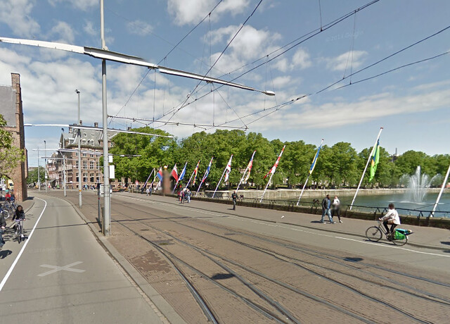
Figure 8. Proposed pedestrian area. Streetview of Buitenhof in front of the Hofvijver that is currently very busy.
The Binnenhof borders the Binnenhof, a main destination not only for politicians, but also for tourists. Along the street there is an indoor shopping center, many restaurants, and a square that has been redeveloped into a terrace. On all three times we have visited The Hague, we have noticed that this terrace is markedly less populated than those further into the center. This is likely due, at least in part, to the busy bordering roads creating an excess of car noise, and the limited accessibility to the area.
For cars passing through, there is not an easily accessible entry for the commercial area. The tram has stops on either end of the road, but none directly in the area in front of the Hofvijver. Bikes are squeezed into a tiny bike lane directly next to traffic, creating a very stressful ride. Pedestrians have space to enjoy the view next to the water, however, there is no place for them to cross over, keeping them isolated from the shopping center.
Eliminating car traffic, and moving the tram below grade, the atmosphere of the route will prosper. With these adjustments, there is ample space for landscaping, bikes, and pedestrians. Creating this pleasant ambiance will greatly increase the economic growth of the area. Tourists passing through the area will take the time to meander the neighboring businesses because of the intriguing atmosphere of the shops. Locals and people working in the area will be more tempted to stop passing through because of the ease of accessibility.
Noordeinde
Noordeinde is the Royal Shopping District of The Hague, filled with history, art, upscale stores, and many restaurants and museums. A part of Noordeinde has already been blocked to vehicle through traffic, and the difference between the car-free and the car-filled areas on the streets is remarkable. Below are two photos that show the boundary between the car accessible and non-accessible areas.
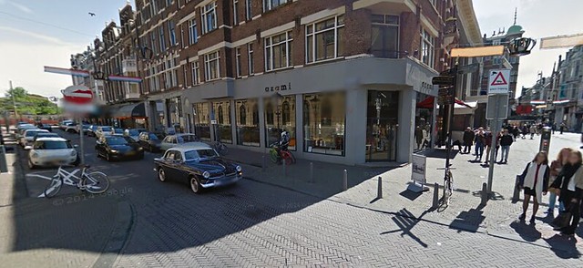
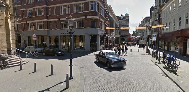
Figure 9 and 10. Corner of Heulstraat and Noordeinde where car-free environment meets car-allowed zones.
In the car-free area, the streets are lined with shops and restaurants, and the streets are filled with tourists and locals. Pedestrians can walk anywhere in the streets at whatever pace they please because there is no fear of vehicle traffic. This increases business prosperity because shoppers are able to focus on purchases without distractions. It creates a comfortable environment for purchasing because the atmosphere is laid back, where a pedestrian can take their time walking through the streets, and not be limited for space when carrying large purchases.
The photo below is the entry into the portion of the road that currently is car free. It is important to note that limiting car accessibility does not affect businesses negatively because deliveries can still be made with ease. At the entry into the area, there is a adjustable bollard that grants access to both delivery trucks and emergency vehicles. In the photo, the road has a lot of pedestrian traffic, which cannot be easily limited to narrow sidewalks.
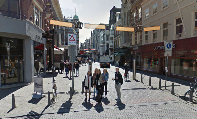
Figure 11. Streetview of Noordeindewith existing car-free environment.
Once cars are allowed, the street quickly becomes much more hectic. There is a noteworthy change in the atmosphere and there are very few pedestrians roaming through the area. This atmosphere limits the advancement of the surrounding businesses because shoppers do not want to spend time where they feel threatened. Adjusting the street to be car free, replicating the connecting portions, will increase the shop-ability, livability and tour-ability of this portion of the route. The photo below is an image of where we would like to limit car access.
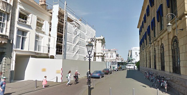
Figure 12. Proposed pedestrian area: streetview of Noordeinde looking North.