Zuidpoldersingel in Delfgauw (William Huang)
Zuidpoldersingel is a distributor road with 1+1 lanes and service roads for local access in the neighborhood of Delfgauw. It is a sustainable and safe road in that it complies with the Dutch Sustainable Safety Principles: functionality, homogeneity, and recognizability. The road efficiently separates fast moving traffic from slow moving traffic without disrupting the flow of either. The 1+1 road allows for fast moving vehicles to flow without worrying about cars turning into driveways, parked cars, or slow moving traffic. Meanwhile, the service roads do not have to worry about fast moving vehicles possibly colliding with them. Each kind of traffic – fast or slow – gets their own spaces to travel, which are also easy to distinguish from each other so that the drivers would know what kind of space they’re driving on.
Figure 1 displays a locus map of the extents of Zuidpoldersingel. A canal can be seen to stretch along adjacent to the road while many local streets also branch off of the road.
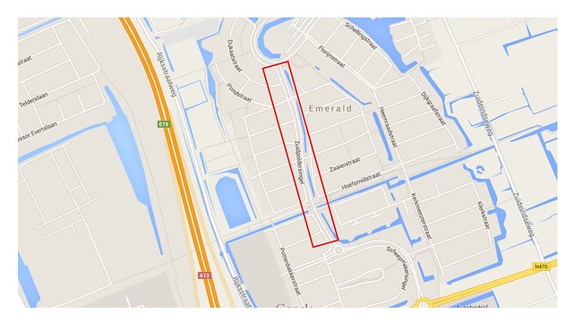
Figure 1: Locus Map
Figure 2 shows a typical cross section of the street found on Google Maps. From left to right, there is a service road without parking, a grass buffer, a 1+1 lane distributor road, a canal buffer, and another service road with on street parking.
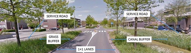
Figure 2: Street View
Functionality
The function of Zuidpoldersingel along this stretch is to distribute traffic onto the local streets of the neighborhood via the service roads. Cars are able to enter and exit the service roads via the cutouts seen in Figure 3. The cutout seems to be a large, stretched out crossing table because cars have to drive over a slant before merging into new traffic.
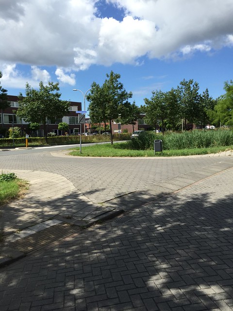
Figure 3: Connection of 1+1 Road to Service Roads
Because the Dutch prefers it for pedestrians to cross one lane of traffic at a time or look one direction at a time when crossing traffic, there are small pedestrian islands seen in Figure 4 for pedestrians to take refuge when crossing the 1+1 road. The street does a good job connecting both sides of the residential area by making the 1+1 road easy to cross.
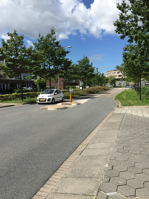
Figure 4: Pedestrian Island
For vehicles, once they enter the service road, they are greeted with speed bumps and different pavement (asphalt for the 1+1 road to brick for the service roads). Vehicles are able to then turn into the streets that they need to. A typical service road can be seen in Figure 5.
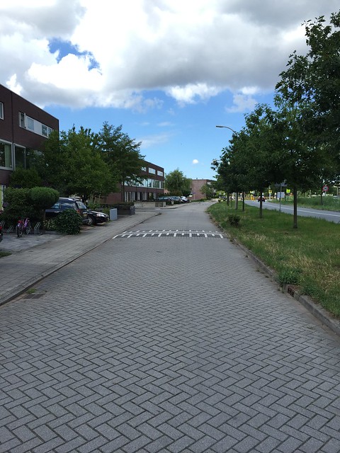
Figure 5: Service Road
Last but not least, the service road function is ensured by being short and ending with a bike lane. This way, drivers won’t take advantage of the service road by driving down the service road for a continuous stretch. The only reason that they would have to drive in the service road is to gain access to the local streets. Figure 6 shows how the street abruptly ends with a bike lane. Furthermore, there is a possible obstruction that can be raised in Figure 6 on the bike lane that can prevent cars from continuing forward.
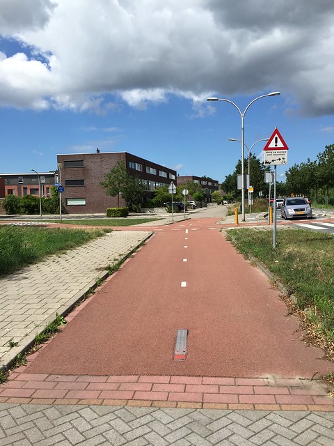
Figure 6: Bicycles Only
Homogeneity
Traffic with different direction, speed, and mass are separated here with the grass and canal buffers as seen previously in Figure 2. The 1+1 road only services fast moving traffic (cars) while the service roads and sidewalks can service slow moving traffic (bicycles, slow moving vehicles, and pedestrians). Fast moving traffic is separated from slow moving traffic by the grass and canal buffers and the raised sidewalk. The sidewalks have a curb to separate pedestrians from bicycles in the service road while the grass and canal buffers are wide and efficient in separating the traffic via vertical obstructions (canals and trees) as seen in Figure 7.
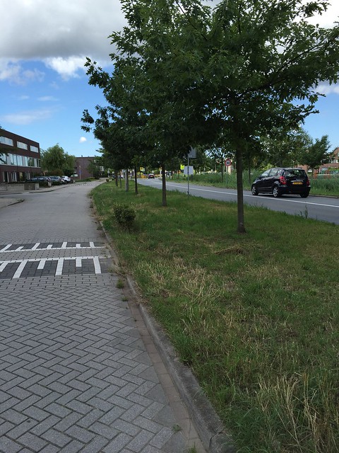
Figure 7: Vertical Obstructions
Recognizability
The streets branching off of Zuidpoldersingel are all for residential usage. A typical local street can be seen in Figure 8. The area is very peaceful with brick pavement, speed humps, and parking spaces which make it very clear to cars that this is a local street and that they need to slow down. The brick pavement and speed humps as opposed to the straight asphalt road on the 1+1 road are physical measures taken to slow down cars. Cars on the 1+1 road might be tempted to drive at a faster speed because there are no vertical obstructions down the straight path except for the few pedestrian islands. For the most part, the road is clear, smooth, and straight. However, on the service road when drivers turn off, brick pavement makes the surface a little more rough and bumpy to ride on and the speed humps obstructs cars so that they cannot go too fast without the possibility of damaging the cars. Parking spaces also force drivers to be aware of people entering and exiting their vehicles. The speed limit on these streets are also 30 KM/H while the 1+1 road is 50 KM/H as seen in Figure 9 where signs warn drivers that they are entering and exiting 30 KM/H zones. It is very easy for drivers to recognize that they are on a service road once they turn off the 1+1 road over the “crossing table” also seen in Figure 9. With all the physical differences between the 1+1 road and the service road, it is easy for drivers to recognize what kind of road they’re driving on and what speed to travel.
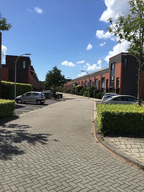
Figure 8: Residential Street
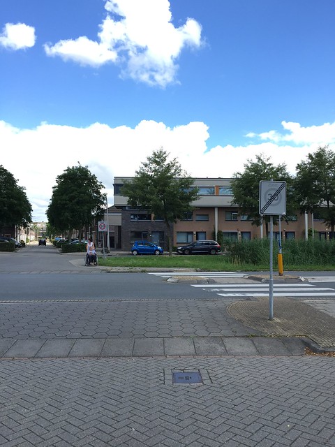
Figure 9: Entering and Exiting Speed Limit 30
Zuidpoldersingel does a very good job in being sustainable and safe.