Group 2: Kathryn Berger, Jenna Bilsback, Anna Guidi, Stephen Mais, Annie Raftery, Darryl Michaud
Overview:
An advisory bike lane is a lane designated for bicycles, but it is delineated with white dashes, which signal to motorists that they may veer into the bike lane if they encounter oncoming traffic. This is why advisory bike lanes are usually used on streets where the road is too narrow to allow for bicycle lanes, yet motorized traffic is not heavy enough so that cars are constantly in the advisory bicycle lane.
In the Hof van Delft neighborhood located approximately 0.65 km west of the historic city center, we observed 3 streets with advisory bike lanes: Hugo de Grootstraat, Adriaan Pauwstraat, and Westplantsoen. Some of these streets had parking lanes and pedestrian crosswalks. The details with the widths of the travel lanes and bike lanes are listed in the tables below:
Table of measurements:
| C1. Hugo de Grootstraat | width (feet) |
| Bicycle Lane | 4.5 |
| Parking | 6.5 |
| Remaining driving zone | 17 |
| C2. Adriaan Pauwstraat | width (feet) |
| Bicycle Lane | 4.5 |
| Parking | 6.5 |
| Remaining driving zone | 11 |
| C3. Westplantsoen | width (feet) |
| Bicycle Lane | 4.5 |
| Parking | 90 degree, head in |
| Remaining driving zone | 11 |
Observations:
From observing these streets, motorists tended to behave in similar ways depending on the situation:
- If only one car and no bikes as well as no oncoming traffic, the car tended to drive down the middle of the road, away from the advisory bike lanes.
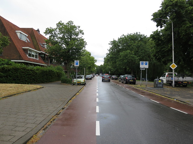
Figure 1. Is a two way road that utilizes advisory bike lanes.
- If there were two cars traveling in opposite directions, both cars tended to stay close to the edge of the bike lane, sometimes veering into the bike lane if the travel lane was narrow.
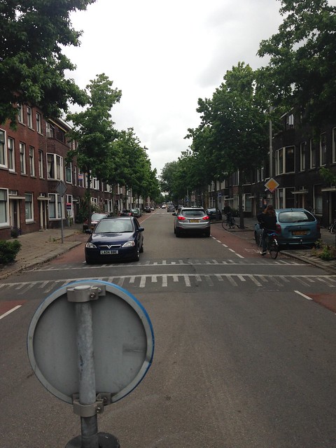
Figure 2. Demonstrates an opposing vehicular interaction on a road with advisory bike lanes.
- If there was one biker and one car, the car moved slightly towards the center of the road.
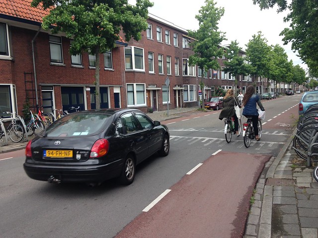
Figure 3. Demonstrates the flow of vehicular traffic when it comes into contact with cyclists on a route with advisory bike lanes.
- If there were two cars and bikers in the advisory bike lanes, cars tended to move to stay close to the edges but slow down or stop until they could pass or use the bike lane.
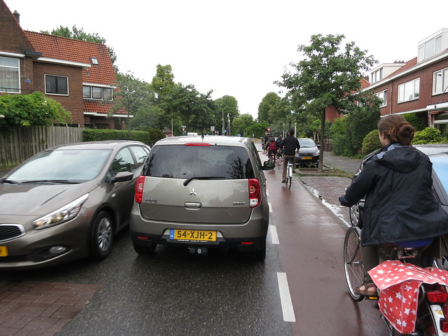
Figure 4. Represents a scenario where there are two opposing lanes of traffic, and bikes on a road with advisory bike lanes.
Cyclists and car drivers appeared to be very comfortable using this road. This seems to work because while there is a frequent flow, traffic is never too heavy, so cars do not have to go into the cyclist lanes too often. The video below shows a typical advisory bike lane in use during off-peak hours.
At one intersection on Addriaan Pauwstraat, there is a pedestrian crosswalk with a sign in the middle that would force two cars going in opposite directions to stop and let the pedestrian pass if there are bikes in the bike lanes. Because the streets we observed were mostly residential, the cars do not drive very fast, which makes this type of street a reasonable area to have advisory bike lanes. One exception was that on Hugo de Grootstraat the travel lane measured 17’, which allocated 8.5’ per car, which is almost an acceptable design standard width. The cars on this street travelled much faster than the cars on Adriaan Pauwstraat and Westplantseon, which had much narrower travel lanes. The road did have speed bumps, but they did not seem to do much to slow the cars down.
Application 1:
One street in Boston where advisory bike lanes can be used is St. Boltoph Street in the South End. The road area is 35’ across with parking on both sides. The width between the parked cars is approximately 20’. If advisory bike lanes were added on both sides with a width 4.5’, there would be 11’ left in the center for cars to share. The parking lanes can be marked as 7.5’. This road is mostly residential so it would not be a very high traffic route, except for locals so the lack of buffer between the advisory bike lanes and the parked cars should not be an issue.
The existing set-up:
The updated configuration is added to the street view below:
https://flic.kr/p/weGLsG
Application 2:
A street where an implementation of an advisory bike lane would be feasible and desirable could be Hammond street in Roxbury, MA. It is mainly a residential area, mixed with college students as well as some lower income residents. A lot of young kids live in the area, and a school bus stops on the corner of Hammond and Tremont in the mornings. Some kids ride their bicycles (on the sidewalk, not on the street). There are a few corner stores, but most of their customers are residents that live nearby and walk there. There are two lanes with traffic in either direction, although it is not very heavy. Together the car lanes span about 20 feet, which means we could allot two 4.5 bike lanes on either side of the road, and would be left with an 11 foot car lane where cars can go either way. Parking currently spans 6.5 feet, so it would be left the way it is currently, and while there is no buffer between bike lanes and the parked cars, all parking is residential, so there would be less danger of dooring.
Here are some pictures that illustrate how Hammond Street would be modified:
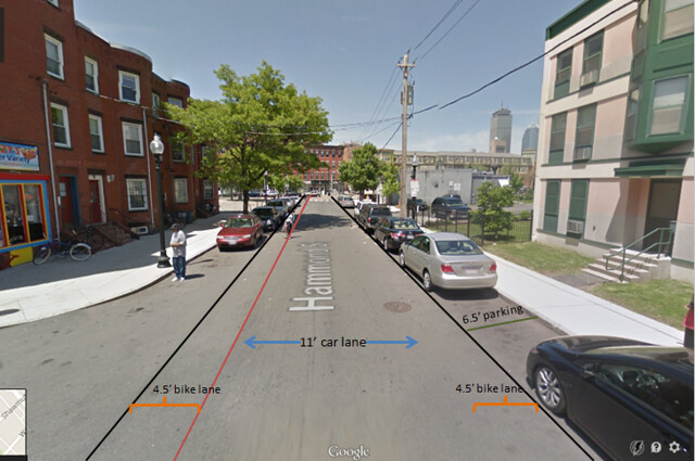
Figure 5. Demonstrates some suggested modifications to a street that would benefit from the use of advisory bike lanes in Boston.