Woonerf
Group 1: Tyler Wong, Molly McNally, Matthew Duranleau, Caroline Lucas, Ryan Cullen, Darryl Michaud, Vanessa Sandoval
[by Molly McNally and Caroline Lucas]
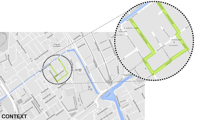
Located behind the train station, this “Woonerf” has been reclaimed from heavy through-traffic and parking and transformed into common space creating “streets for the people.”
Locus Map:
Observations:
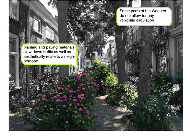
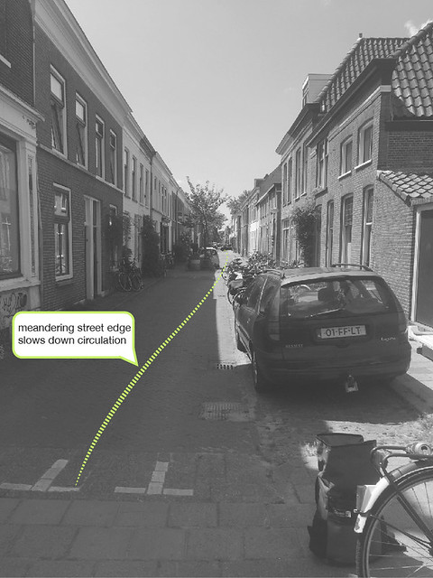
This “homestead” made the most of limited space. For this typology to transform from a typical street and into public space, both horizontal and vertical diversions, including speed bumps and chicanes, limited parking, diverted traffic, and lowered vehicular speed to 6 km/hr. The now existing shared space creates accessibility for pedestrians, cars, and bikes.
There has been a significant change from a car-dominated street with no sidewalks into an activated street edge. Common material choices, both planting and paving, throughout the Woonerf created a cohesive shared space.
Site Recommendation
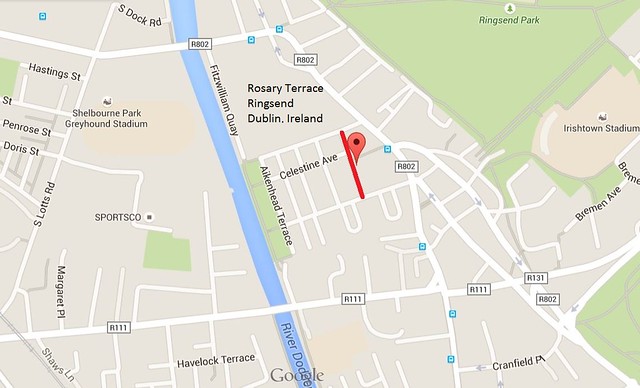
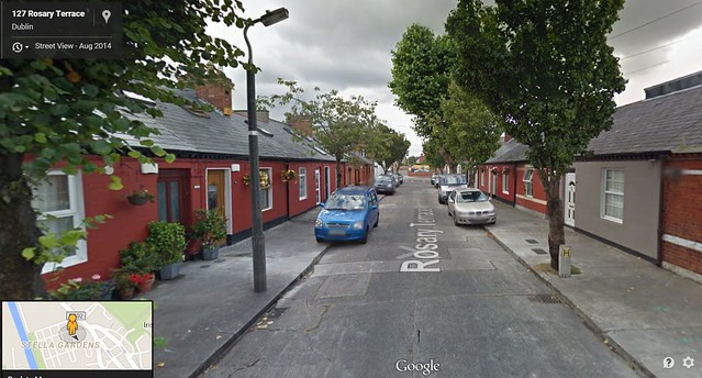
The Ringsend neighborhood of Ireland features many narrow streets, with no room for residents to have any kind of front yard or space for interaction with each other. Rosary Terrace is one such street. As shown in the street view above, cars are forced to park on the sidewalk in order to make space for a single lane of traffic. This street would benefit from a transformation to a woonerf, in which parking is limited and more of an emphasis is placed on making it a safe living space. Introducing speed bumps and chicanes in order to discourage any through traffic would allow residents to enjoy the street to the fullest.